St. Thomas/Cedar Point Neck
St. Thomas/Cedar Point Neck
Approximately 4000 acres of land was purchased by Rev. Thomas Copley in 1649, including St. Thomas Manor and Cedar Point Neck, located across the Port Tobacco River. The Jesuits had established a presence there as early as 1642, connected to their Piscataway mission.
The land was worked by indentured and enslaved laborers, who grew tobacco and corn, and by the 18th and 19th centuries, wheat and other grains.
Learn more about St. Thomas/Cedar Point Neck
-
Georgetown Slavery Archive
-
Maryland Province Archives at Georgetown
-
Today, portions of St. Thomas Manor are still owned by the Society of Jesus, while the majority of the land is owned by the State of Maryland. Much of Cedar Point Neck is owned by the U.S. Army as Blossom Point Test Facility.
-
Learn more about the history of St. Thomas at the Georgetown Slavery Archive and through the Maryland Province Archives at Georgetown.
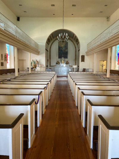
Archaeology at St. Thomas/Cedar Point Neck
There are numerous but yet unstudied archaeological sites at St. Thomas manor where enslaved Africans and Black tenant farmers lived. An 1867 map shows the location of “cabins” and “dwellings,” which were probably the homes of enslaved Africans and free Blacks. A 1905 map describes “Tenant Houses or Negro Huts”.
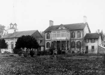
St. Ignatius Church and St. Thomas Manor House
St. Ignatius Church and St. Thomas Manor House: Enslaved laborers constructed a brick residence for the Jesuits at St. Thomas between 1741 and 1750. The house was attached to an earlier church. It burned in 1866, and was subsequently rebuilt. An archaeological survey was conducted in 1987 prior to utility work, showing that archaeological deposits are preserved here. St. Ignatius Church/St. Thomas Manor is listed on the National Register of Historic Places.
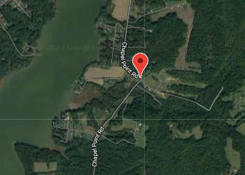
Slave Quarter
Enslaved persons who worked in the house at St. Thomas Manor during the mid-19th century probably lived in this dwelling. Is listed on the Maryland Inventory of Historic Properties. Please note historical inaccuracies in this listing, which states that the Jesuits freed enslaved Africans in 1833.
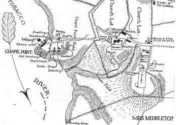
Historical Maps
These maps are consistent with historical references: “at St. Thomas’ there seems to have been a whole village of huts, perhaps a hundred of them…They were built near the residence, some along the Hamilton lot, others opposite along the road, and others again near the farm house, called Riverview; here a bachelor’s quarter has been turned into a chicken house, and a full quarter is inhabited by an old negro, who rents the old ramshackle to the account of charity” Joseph Zwinge, Woodstock Letters, 1912.
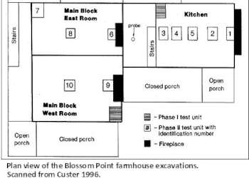
Cedar Point Neck Archaeological Sites
Blossom Point Farmhouse, 18CH216. Read more at the MAC Lab.
Extensive archaeological surveys have taken place at Blossom Point Test Facility, revealing the location of dozens of archaeological sites, and several distinct dwelling sites.
