Approximately 3000 acres of land was purchased by Rev. Thomas Copley in 1636/37, including 2000 acres called St. Inigo’s Manor, and an adjacent 1000 acres called St. George’s Island.
Land was worked by indentured and enslaved laborers, who grew tobacco and corn. By 1717, 17 African-descended laborers were enslaved at St. Inigoes.
By the middle of the 18th century, enslaved laborers also cultivated wheat, oats, barley, apples, and peaches, and cared for horses, cattle, sheep, and poultry.
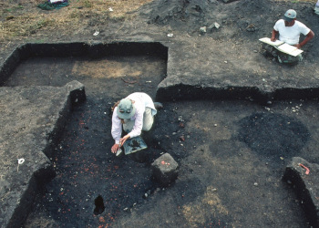
St. Inigoes contains over 70 distinct archaeological sites. Enslaved ancestors lived at many of these sites, including the tenant farms documented as 18ST347 and 18ST386. The slave quarters documented by Mobberly were destroyed in the twentieth century, but their approximate location and scattered archaeological remnants—a few fragmented artifacts—have been documented.
Old Chapel Field (18ST233)
Indigenous and ca. 1637-1660. Following centuries of use by Native American communities, this site was inhabited by English colonists and indentured servants, who primarily built earthfast features. Learn more at the MAC Lab or Colonial Encounters.
Old Chapel Field/Fly (18ST329/330)
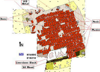
Indigenous and ca. 1680-1760. This site is just south of 18ST233. It shows the development of the Anglo-American settlement at St. Inigoes, and the construction of a large plantation in the early decades of the 18th century. Remains of several cellars, a dwelling, a brick building, and a kitchen “midden” (trash pit) have been discovered. This is the site where the first enslaved Africans at St. Inigoes, like Susan and Betty, worked and probably lived. Read more at the MAC Lab.
St. Inigoes Manor House (18ST87)
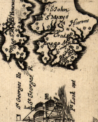
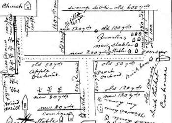
Sometime between 1740 and 1760, enslaved Africans like Matthew built a large manor house at a promontory of land on the St. Mary’s River, known as “Priest’s Point.” The center of the plantation moved from Old Chapel Field to this location, and it is depicted in Brother Joseph Mobberly’s ca. 1820 map. A dwelling (ca 1760-1942) that was probably the home of Louisa Mahoney Mason is also located at 18ST87. Read more at the MAC Lab.